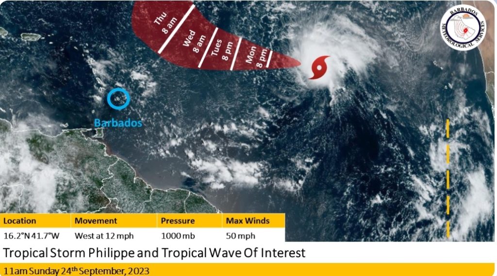
Overnight Tropical Depression #17 was upgraded to Tropical Storm Philippe, which was located at 16.2N 41.7W or about 1940 km or 1200 miles to the east of the region at 11:00 a.m. today, Sunday, September 24, 2023.
At present, the maximum sustained winds have increased to 50 mph and the minimum central pressure is estimated at 1000 MB.
This system has become better organised this morning with deep convection being sustained around the center. Model guidance continues to track the system westward to west-northwestward over the next few days. On its current track, this system is still projected to pass north of Barbados during the early to mid part of this week. As a result, lighter wind speeds and warmer daytime and nighttime temperatures are expected during the week, which may result in some discomfort.
Additionally, a small area of low-pressure embedded within a tropical wave located around 23W is also being monitored for further development. Environmental conditions are forecast to become better conducive for the slow development of this feature and a tropical depression could form during the mid to late part of this week.
Key messages:
- There are currently NO WATCHES OR WARNINGS IN EFFECT FOR BARBADOS.
- The public should stay alert for updates from the BMS on these systems over the next few days
-Warmer conditions are expected this week
The next update will be at 11:00 am tomorrow Monday 25th September, 2023.


More Stories
Plans for Royalton CHIC Barbados unveiled
BMS issues Flash Flood Watch
Man dies following stabbing incident